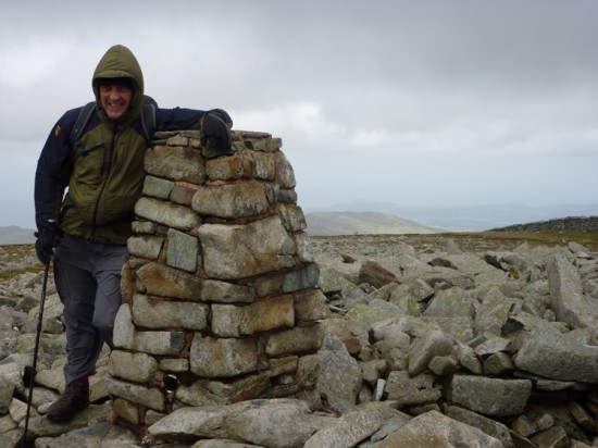
 Force eight beside the trig on Foel Fras
Map of a Nation by Rachel Hewitt.
Review by John Levell.
It was with Anne, my long-suffering wife, at the wheel on the four-hour drive to North Wales that I took the opportunity to start Rachel Hewitt’s biography of the Ordnance Survey, Map of a Nation. I must admit to feeling a little dubious about the prospect as almost 20 years ago to the month, I retired from the OS after spending the previous 20 years as a surveyor with the agency. Changes were sweeping through the OS at the time of my leaving, the large-scale revision was reaching completion and the digitising process, the forerunner of the present day OS Master Map, had become well established. I left with some sadness and some frustration as the survey work I had joined the OS to be part of had become a distant memory. Fiscal restraint, satellite positioning and computer technology vied to see which could bring about greater change. It was with these mixed feelings I asked Anne and our two travelling companions if they would excuse my antisocial behaviour if I buried my nose in a book.
My reticence was to last but minutes; within the first few paragraphs the open and engaging nature of Rachel Hewitt’s writing had me captured. Not the one-time professional cartographer, but the lover of maps that first drew me to the OS that is so much a part of the British psyche. The depth of research into the military and political intrigue and struggles that were the foundation of the Survey brought the history or the period to life. You quickly define the character of those who had the vision and foresight, those who wielded the power and those who had the talent and ability to achieve the goal of a national map.
The military campaigns to quell the Jacobite risings and the aftermath of searching for the leaders in the highlands during the mid-18th century were the spark required to provide more complete military mapping of Scotland. The political consequences of the difficulties experienced in that highland wilderness has historical appeal far wider than the story of the map makers and the reader feels able to understand the difficulties of the soldiers in the hostile mountains, so loved and familiar to modern day map users as they trudge high ridges to bag yet one more Munro. The political backdrop necessary to find support for what was then such a revolutionary project is pieced together as political fortunes ebbed and flowed. Whether sympathies lay with the hunter or the hunted, it was the needs of the King’s troops that gave rise to the process of mapping the vast Scottish landscape. Military needs continued to drive the map makers as, through the latter part of the 18th century, the struggles with France brought the need for mapping from the far north down to the south coast. We are introduced to the great thinkers who championed the need for mapping, discovering backgrounds and family history in the finest detail. I had been led to understand the OS came into being at a precise point in time – 1791 as a result of the actions of one William Roy – so the far more involved process that has been so painstakingly recorded here came as a revelation. Readers can’t fail to be impressed and absorbed into this fascinating account that puts the flesh on the bones of the maps we find so fascinating.
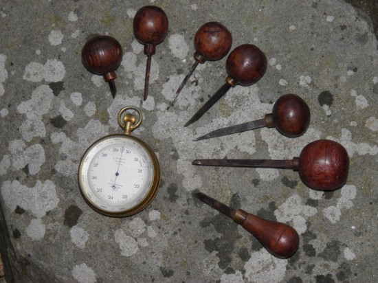
 A barometer as used in association with observations and engraving tools that sit on my desk
We not only meet the men of vision, we are introduced to the techniques and the very instruments that made such mapping possible. The mathematics and many of the techniques used by these early cartographers remained little changed up until the last few decades. The instruments may have been more compact and of a higher quality in latter years, but the properties of a triangle have remained unaltered. In my time there were probably one or two more factors that had to be included in the calculations to take account of temperatures, curvatures and grids, but the equations would still probably have been recognisable to William Roy. I was fascinated to read of the construction and difficulties of using the Great Theodolite used to set out the first triangulation. I sympathised with the difficulties of measuring accurate baselines and exact angles, where our laser geodimeters and today’s GPS managed it at the flick of a switch. The problems of mist, rain and heat haze were as real to William Roy as to me and brought them flooding back into my memory. Hours and hours standing beside set-ups waiting for conditions to improve came back in a flash. Freezing fingers, streaming eyes and failing light, with further rounds of pointings necessary to achieve the mean angles required before the day is abandoned and a completely new start has to be made tomorrow. How the men of those early years observed that first triangulation and achieved such accurate results will never cease to amaze and this beautifully crafted book is a fitting tribute and long overdue recognition of their achievements.
With the mapping of the country now underway, readers are then acquainted with the various county maps and extensions to the triangulation network that were built into the final survey. The original measured baseline on Hounslow Heath, which now forms part of Heathrow, supplemented with further baselines to confirm accuracy. My own curiosity with regards to maps, the Sarum base, is reassuringly recorded as the survey heads west into Wiltshire and Dorset. We are introduced to the difficulties of surveying In Wales with its notoriously confusing place names – the lengths the surveyors went to to ensure the correct spelling would eventually be included on the map are set out and triggered many memories. While not recorded and probably not current at the time covered by the book, the name and authorisation form numbers OS 21 and OS 232 are as fresh in my mind now as in the ’70s when I worked in Wales, stamped indelibly in my mind. Small and some might think minor details such as the curiosity and even suspicion the early surveyors encountered is so very real and adds a further layer of humanity to the tale. The further I got into the book the more memories and details that I had never considered significant were brought back into being, all beautifully recorded with an obvious enthusiasm and almost tangible passion for maps.
The politics, intrigue and wars that gave rise to the national mapping agency also provided the first step in the involvement of the public with the Ordnance Survey. Government agencies that can claim to be the nation’s favourite institution are few and far between, but the OS can justifiably make that claim and this book allows us to understand the reasons behind that support. The steps from triangulation to publication are followed through the infilling of the land detail by further ranks of surveyors as they progressed from county to county, region to region. The work of the draughtsmen and copper plate engravers, then based at the Tower of London, to trace the minutest survey detail with the added coastal shading and relief hachures that bring the impersonal survey to life. Those copper plates were to produce the first maps available to the masses and gave rise to the public love affair with both maps and the Ordnance Survey across the UK.
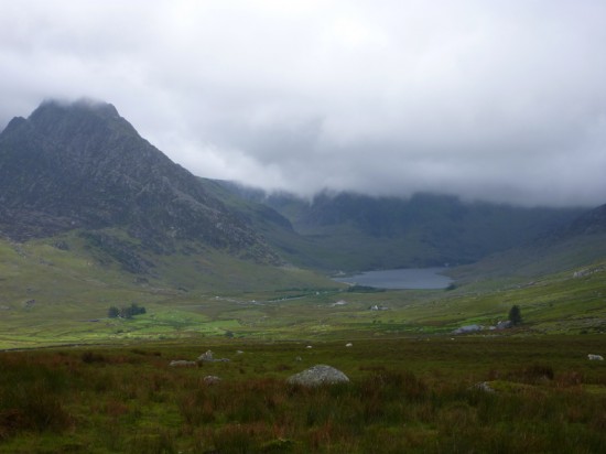
 Llyn Ogwen below Tryfan with its top in the clouds.
Time is taken to further examine the public delight in maps – the essence of freedom, to follow a path of your own choosing, or the reassuring companion always to hand. Our trip to North Wales was a simple example of the relationship that the public have with their mapping agency. Now, as a map user as opposed to a map maker, I was heading for the Carneddau – a road-free upland that contains seven peaks exceeding 3,000feet, a great deal less crowded than the better-known Snowdon range. We were expecting poor weather with a cloud base less than 2,500feet for part of the route, but we felt quite confident as our pack contained the OS Explorer Active Map and a good compass. Despite my mobile GPS, I still took comfort in having that reassuring friend to hand if required.
Starting this book with mixed feelings of sadness and frustration of my time with the OS, I finished it with a renewed wonder in the achievements of the pioneers of the national survey and a renewed pride in my association with the agency. Such authoritative books are rare things and I would recommend to all who have feelings for maps and our UK landscape to take time to read Map of a Nation. It will add to a greater understanding of events leading up to our present day satnavs and Google Earth programmes that have developed as a result of the efforts and dreams of those so imaginatively recorded in this book.
John Levell left the O.S. to work on the Somerley estate in Hampshire. Twenty years later, he describes his role there as “encompassing forestry, roads, cottages and every other problem that appears to arise”. He is most likely to be referred to as the “River keeper”. John blogs the day to day life of the river in his excellent Avon Diary,
Map of a Nation is out now in paperback and available from our shop, priced £7.00