by Lisa Samson
It is the end of another week of torrential rain and flooding across Britain and I seize the first clement day to head for the dales with my dog. The farmers brought in the harvest a few weeks ago and the cows have been moved to the open moors. Ducks flap and swim on a newly formed pond in the middle of a flat field. The River Wharfe is swollen and the fields sodden, but from what I can see there is no serious damage.
A quiet Friday afternoon in Grassington but the little town is still busy with shoppers. This prettified town was once a more humble place, the centre of the lead mining industry that dated back to Roman times. Grassington Moors are still pock-marked with spoil heaps and bell pitts, down which an unsuspecting walker could easily tumble. But today I am heading for one of my favourite spots, the limestone paving of Cove Scar above Grass Wood.
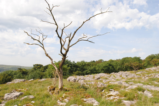
Stepping over the cracks between the limestone pavements reminds me of being at the seaside and the circular hollows on their surface are filled with water, mini rock pools perfect for my dog to drink from. The stones are white like bone, worn into shapes that waver like water trickling down glass. There are limestone outcrops all over this area, a characteristic of the landscape formed in the ice age.
Battered ferns lie in sad clumps at the base of the scar, on the area where the medieval settlement is supposed to have been. I’ve heard it referred to as Old Grassington and it is believed to be the original site for the village. An archaeological dig some years ago uncovered pots dating back to the 14th century and these are now housed in Skipton museum. If you look carefully, you can see level areas where cottages might have been.
Cattle slump amongst the craggy outcrops or lumber across the rough grass to find sweeter grazing higher up. I am relieved that they are not interested in me or my dog, and do not even deign to turn their huge heads in our direction. Curly hawthorns, bent into submission by wind and rain, are lone weather warriors to defend the ancient settlement. Their thorns protect them from the cattle and humans leave them alone because their blossoms are thought to presage illness and death if brought into the house. But there are no blossoms on this glishy September day of sun and rain.
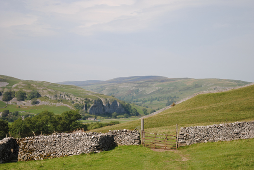
I return to this limestone plateau again and again, and every time I remember a black and white photo of myself and my sister at 5 and 7 years old, wearing ponchos crocheted by our grandmother, seventies children of hippy artists, prancing on these very rocks. Since then, I have picnicked here many times with my own children. It is but a mile from the village and the grind of an industrial saw has accompanied me from Town Head farm, but it still feels wild and rugged, a landscape weathered by wind and rain, scarred by mining activity but whose topography has remained intact. Across the valley, Threshfield Moor stretches up Dolmire Hill, like the back of a giant bent in prayer, imploring the black clouds not to rain.
The first part of this walk over the moors follows the path to Kettlewell, but I turn left before I reach the five limestone ridges that curve round five green plateaus, steps that stagger above Conistone village. They look like a man made fortress and would have afforded long ranging views of the surrounding country. But the limestone walls that separate the grassy ledges might also be the result of rock clearing for crop farming; each strip might have formed a lynchet for sowing barley, oats or beans in the early medieval period. On the Ordnance Survey it is marked as Hut Circle and Field System.
I let my dog off the lead so that he doesn’t drag me down a scree slope but by the time I reach the bottom he has disappeared over the brow of the next hill and I have to give chase. His sharp nose can catch the scent of sheep a mile away. Bleating and barking carry on the still air. Sure enough, he has cornered a sheep in a field and I get to him just as he is about to take a bite of wool. Fortunately, he obeys my command “Maddox, sit!” and I am able to catch him and drag him away, frothing at the mouth.
Holding Maddox on a short lead, I stumble down to the lane at Conistone, glad to be on firm ground for a short while. After following the shady lane for one mile, I join the river path which forms part of the Dales Way and here I meet the only other walkers out today, two bald men who greet me with “Mind t’ river, lass”. Although the river is bubbling higher up the banks than usual, I am on a dry path so, unless it was to leap up at me, I can’t see what danger they think I might be in. Maybe they mean listen to it, be mindful of it, so I sit to rest on my favourite bench looking down at the waves chasing each other between a rocky island and the bank.
photos by Joel Hitchins-Samson

