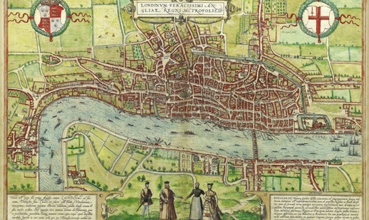
The human curiosity for cartology runs deep. A new exhibition at gallery@oxo, South Bank – as part of next month’s Totally Thames festival – celebrates the art of mapmaking over a 450 stretch of time, with rarities to visually document the dramatically shifting landscape of the Thames.
It’s been curated by Daniel Crouch, one of the world’s leading map dealers, and includes “very large maps not normally viewable as framed works of art, the first three printed surveys of the capital, dating from 1746, 1799 and 1827 – the largest of which is 4m by 2m.” There’s even the first ever available map of the capital, which dates back to 1572.
It runs from Sep 4th-14th, is free and there’s more info here