 Illustration: Julia Stone
This extract is taken from the full essay published in the latest issue of the delightful Elsewhere: A Journal of Place. Many thanks to Paul Scraton and Amy Liptrot for allowing us to repost.
Words: Amy Liptrot
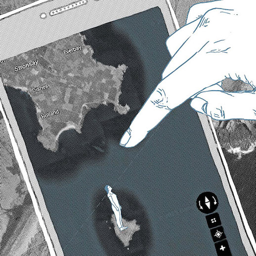
On a train travelling south through England, on the East Coast mainline, my phone is in my hand and I open Google Earth. From 1,100 km out, I have a God’s-eye view and spin the globe on the screen with my fingers like a marble. I have the world between my thumb and forefinger, but the first place I want to find is home. I pull my territory towards me like a parachutist coming in to land.
I find Britain, then go north, following motorways and rivers like a migrating bird. The islands of Orkney, where I grew up on a farm, are grouped together. There are 30 or so irregularly shaped islands and their names float above them in white type: Hoy, Rousay, Westray, Mainland. For the last three years, I’ve been living with one foot in Orkney and the other in the internet. I pull this suitcase up and down the country every few months, always leaving and returning like the tide. This time I’m leaving for nine months or more and, as I travel south, my phone finds new networks.
I departed on a ferry but, inside Google, I approach by air, zooming in: 10 km per inch, 5 km per inch. I’m reaching down through the sky. The isles of Auskerry, Swona and Sule Skerry are remote enough to have their own isolated patches of digital map, out in the default ocean blue. My islands are in the palm of my hand: odourless, fixed and digitised; held cloudless and summer fresh. This is where I’m from but the familiar becomes strange.
Pictures of Orkney, taken on rare, clear-skied days by commercial satellites or aircraft, are stored in massive servers in South Carolina or Iowa or Dublin or Finland, and are now called up in a moment and transmitted by fibre optic cables under oceans and through mobile networks, to me on my train travelling south at 90 mph.
The main island is divided into fields of different greens, with irregular brown areas of hill land. I see the land as a bird does. There are few trees or areas of cover. I’m following lochs to burns to the sea. At the edges of the isles, the ocean is churned up around the foreshore. I’m looking for whales on satellite photos.
To find out when the pictures were taken, I’m performing deduction by observing grazing systems, livestock intensity and verdancy – telling the season by the crops. Most fields are lush green but some are cut or recently reseeded. It is after the first silage cuts in early June. I can tell the time of day by using wind turbines like sundials; they cast long shadows to the south-west so it must be early morning. I can tell it’s high tide because outcrops of rock, that I know are there, are not exposed.
The landscape is marked by geological fault lines, by neolithic remains – burial mounds and boundary dykes – and by agriculture: disused peat banks cross the hillsides like an electronic circuit board. There are the scars of war: WWII runways, hillsides pocked with craters; and of industry: an oil terminal, piers built for tankers; and of leisure: putting greens at the golf course.
I zoom in closer: 2 km per inch, 1 km, 500 m, 100 m, then 25. There are yachts in the marina and cemeteries by the sea. From above, fence posts look like standing stones. Bales stand in fields. I peer into roofless crofts and walled gardens, inside the Stone Age houses at Skara Brae, inside the huge containers at the oil terminal. I look into the back gardens of island houses bought by their inhabitants to get away from attention.
I scroll over to the west coast, to the farm where I grew up and where Dad still farms. Familiar fields are pixelated. Here’s the ditch where we left our bikes to catch the school bus. Here’s a stretch of drystone wall I rebuilt last winter. Here are some dots: they look like crop circles but I know they are where my Dad has been moving the sheep’s ring feeder.
I look at uninhabited islands, close enough to make out the shapes and shadows of seals hauled out on the rocks. There are digital glitches. Different layers were photographed at different dates and I’m flipping between 2008 and 2010, now 2006, uncovering layers through digital archaeology. I cross a field and I’ve gone back two years. Always resetting, inside a constantly iterating map, it is all time travel.
Every photograph is of the past. I’m not looking at Orkney as it is now – with a new season of crops, another year’s growth – but the moment at which the satellite took the pictures. This is the wave that was captured to stand in place of all future waves.
Elsewhere No.02 features writing from Tamchy, Melbourne, Mumbai, Cabo de Gata, Dresden and, of course, Orkney, as well as a feature on the Night Train, photography, interviews and reviews. You can order Elsewhere for €12, including delivery worldwide, from here.
Amy Liptrot’s The Outrun is due to be published by Canongate in January 2016. Amy will also be joining us at Caught by the River Calder, 22-4 January. More information here.