In part one of a serialised walk along the Jurassic Coast, Malcolm Anderson takes the path less travelled.
The river Axe boils as it clashes with the wind-driven chop of the English Channel over the shallows of the River Ledge at Axmouth. Brown and high after rain, it looks particularly quarrelsome and mean spirited today. It feels like a different place entirely to my half-remembered childhood memories of the place; jumping off the concrete sill into the river current on summer days to be dragged out into the channel and dumped onto the shingle of the beach, breathless and laughing.
Today, upstream slightly from the river’s mouth, children sit on that same high concrete slab which constrains the river into a straight edged channel, and dangle crab lines down into the salty estuarine waters. Ear-piercing squeals of excitement cut through the background noises of moving water and gulls as crabs are gingerly picked up by their shells and then dropped as soon as they move. I suspect the crabs are unperturbed by this capture and handling, and scuttle back to the ledge quickly, retreating home with a ‘plop’. The children however seem terrified and delighted in equal measure. If this is their sole encounter with the wild, I hope their memories last a lifetime. The wild is, I believe, going to need their help in the future.
A group of weekend motorcyclists sit outside the café as I walk past; the air smelling of bacon, leather and cigarette smoke, but beyond these human smells is the unmistakable tang of salt and the ozone-rich smells of the tide.
The Axe is the river of my childhood. Rising in the hills above Seaborough it defined much of my youth. Whether swimming, raft building, fishing, exploring; much of my time was spent on its banks in its upper reaches, but these are stories for another day. Today I’m at the river’s end. After its short journey from the hills on the Dorset/Somerset border I’ve come to the point where the words cease to appear on the map and its meanders, riffles and pools merge into the wide expanse of brine.
For some time now I’ve been wanting to walk the stretch of the SW coast path as it runs through the undercliff from Axmouth to Lyme Regis again. I walked the path as a child with parents and explored this stretch of coast many times in my younger days where we looked for hidden waves to surf on the rock ledges, or forgotten beaches for parties in summer months. However, It’s been years since I was back and I’m aware that in this geologically agile part of the world, things move from one month to the next, let alone decade to decade. So I’ve arranged a lift from dad and get dropped off on the main road as it bends over the river towards Seatown.
Walking away from the bustle of the concrete sill and the café, I’m faced with a choice. The signposted and well-worn coast path, which I know spends most of the distance to Lyme in a shady tunnel of trees, or set out on my own along the open beach and follow the coast. Feeling the need for solitude and with a nod to Robert Frost, I check the tide times (three hours to low tide), step onto the shingle and take the path less travelled. It’s a pattern that for good or ill I seem to have fallen into for much of my life.
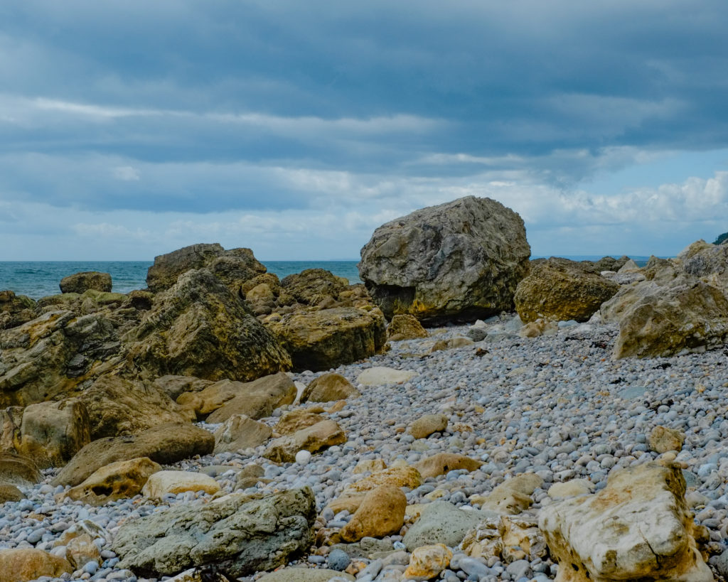
In front of me the wide sweep of shingle beach is bordered by white horses atop the grey-green sea to my right, and the loose red slope of Haven Cliffs which seems to sit sluggishly, like a bored teenager on my left. The only sound is the deep breath of the English Channel as it rushes up the steep pebble bank and then falls back with a long drawn out foamy sigh.
I shoulder my pack and set off across a sea of pebbles the size of my fist that shift under every step, making progress hard going. My steps crunch and echo on the empty beach, the sound of a hundred invisible troops marching in formation with my feet. Crunch. Crunch. Crunch.
By the time I reach the first bend in the coast at Sparrowbush Ledge, where the rocks jut out into the water in a tumbling mess, I’m wondering about the folly of taking the less travelled path. Every step stresses ankles as my feet slide seawards; honestly it’s just bloody hard work.
I clamber the crumbling rocks of the headland and immediately the pebbles are replaced by larger rounded boulders. Walking is now a game of stepping stones and I have to permanently look down to check my footing. The view of the channel slides past unnoticed, the oak and scrub choked cliffs inland, ignored. From Sparrowbush Ledge to Culverhole Point this continues; every step measured and considered.
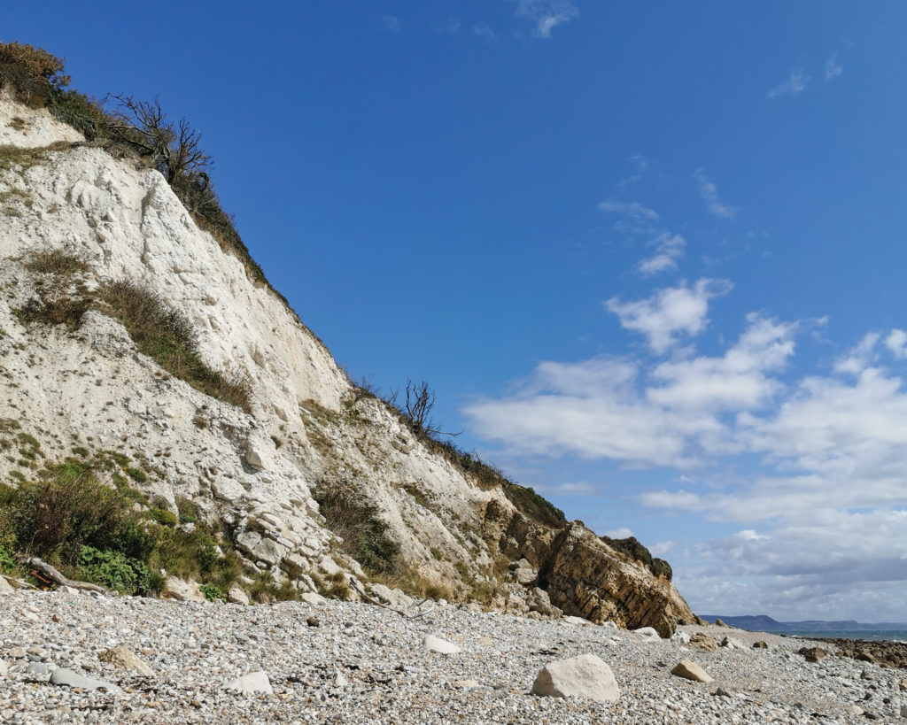
The big cliffs around Culverhole stop me in my tracks as I approach. Despite checking the tides the water is lapping quite close to its base. This is the bit I didn’t like the look of on the map, and it’s the bit I don’t like more now I’m here. I’ve seen too many of these looming stone monoliths tumble before. I’ve heard of one too many deaths and narrow escapes to be comfortable passing in its shadow.
Ridiculous I know, but I pause for a good five minutes before I finally rustle up the courage to pass through the shadow and even then I run. Hopping from slick green boulder to slick green boulder, as far from the base of the cliff as I can manage without wading. I’m a little shaky by the time I’m back in the safety and sunlight of the open beach. Another hour. Another hour for the tide to drop more and I would probably have been able to walk a bit further away. Hindsight is after all a beautiful thing.
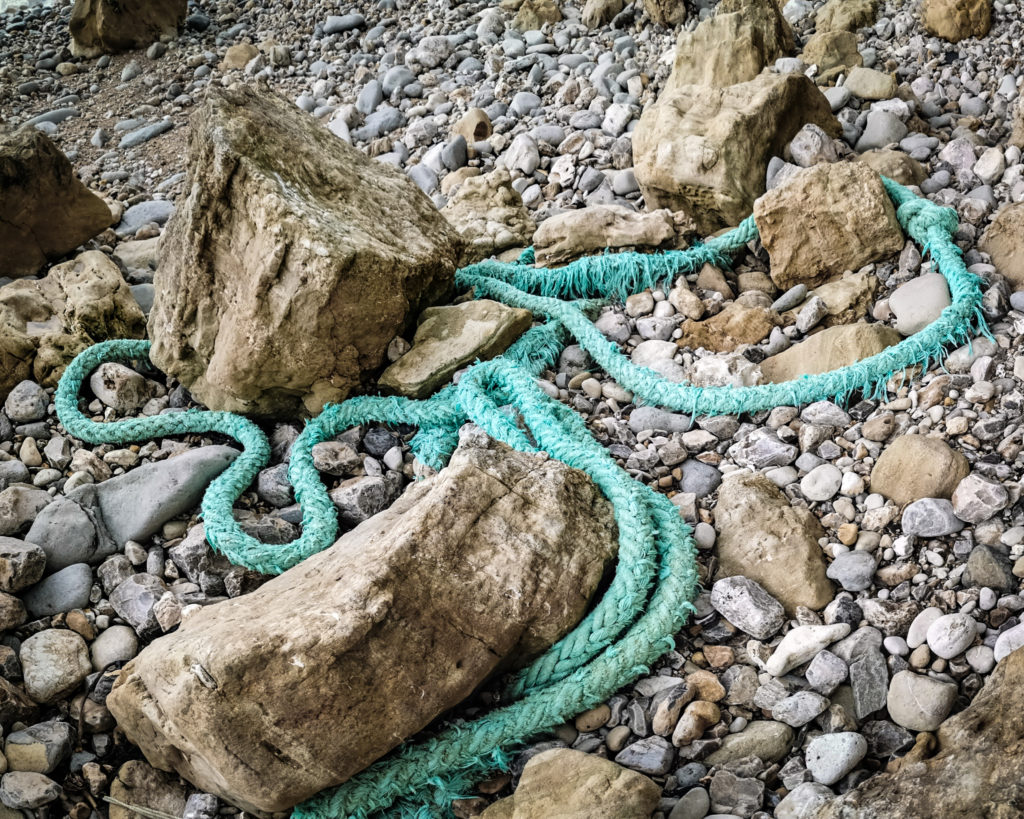
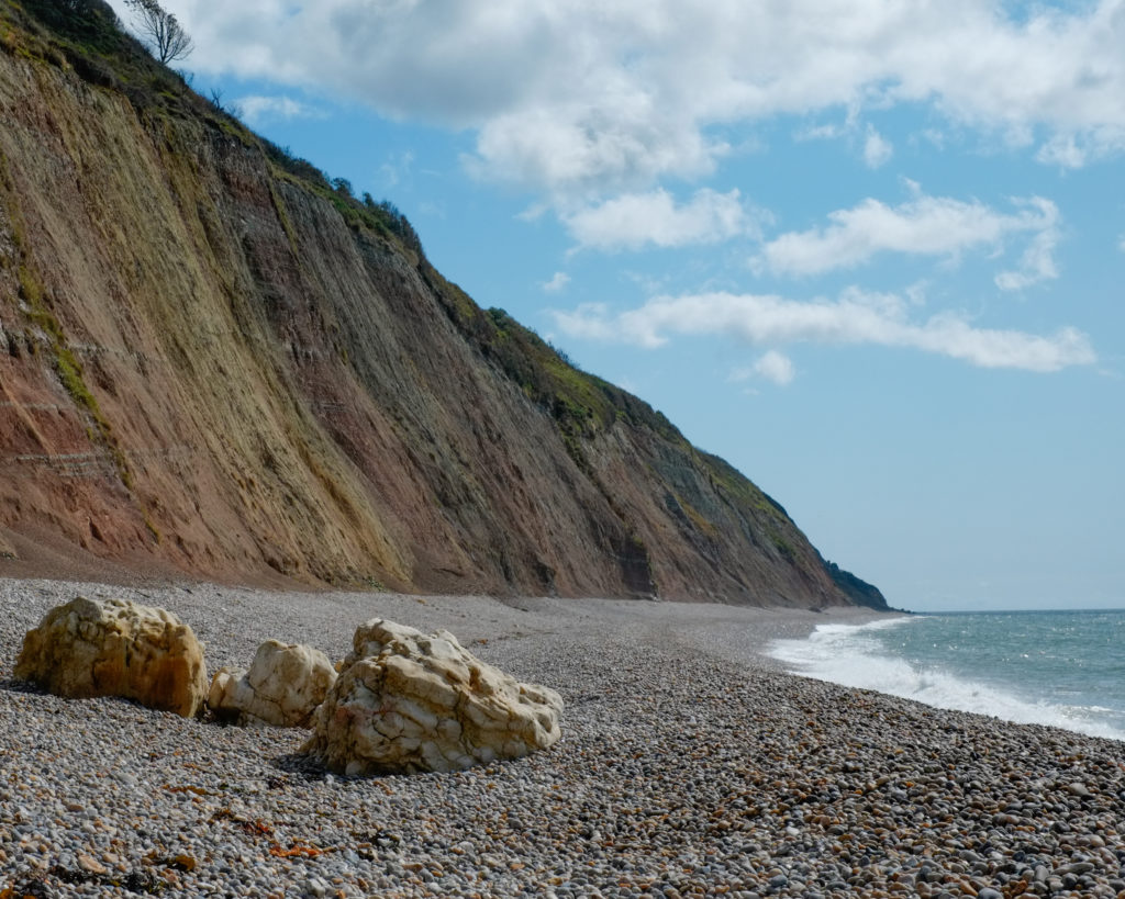
I thread my way through Corbin Rocks, flat-topped boulders ranging in size from VW Beetles to bungalows, and I find myself remembering serac fields of my alpine past. A lost mooring rope, as thick as my upper arm, coils around one boulder; a jade green plastic python wrapping itself around its coarse gritty sandstone dinner. I scramble up to take a photo of the rope and looking inland realise that I’m now level with the weighty presence of Bindon Cliffs and behind that, the large treeless form of Goat Island which formed in 1839 when a kilometre-long strip, 100m wide, tore away from the mainland. The violence of that event left behind an inland island with a jagged-cliffed chasm on the northern side. Up until relatively recently, the coast path ran through the tree lined fractured landscape which runs between me and Goat Island, but a further landslip means that the path diverts up and across a part of the island itself. Somewhere behind the cliff in front of me I know that serious-booted and backpacked people are walking the waymarked path, and I guarantee you they are cursing the route of the new path as it climbs the steep turn onto the island.
Here on the beach, however, everything is silent but for the shifting sea. It’s just me and the cormorant sunning its outstretched wings on the ledge just offshore (is it just me that quietly mutters ‘or shag’ and sniggers in a juvenile fashion, when I see one?)
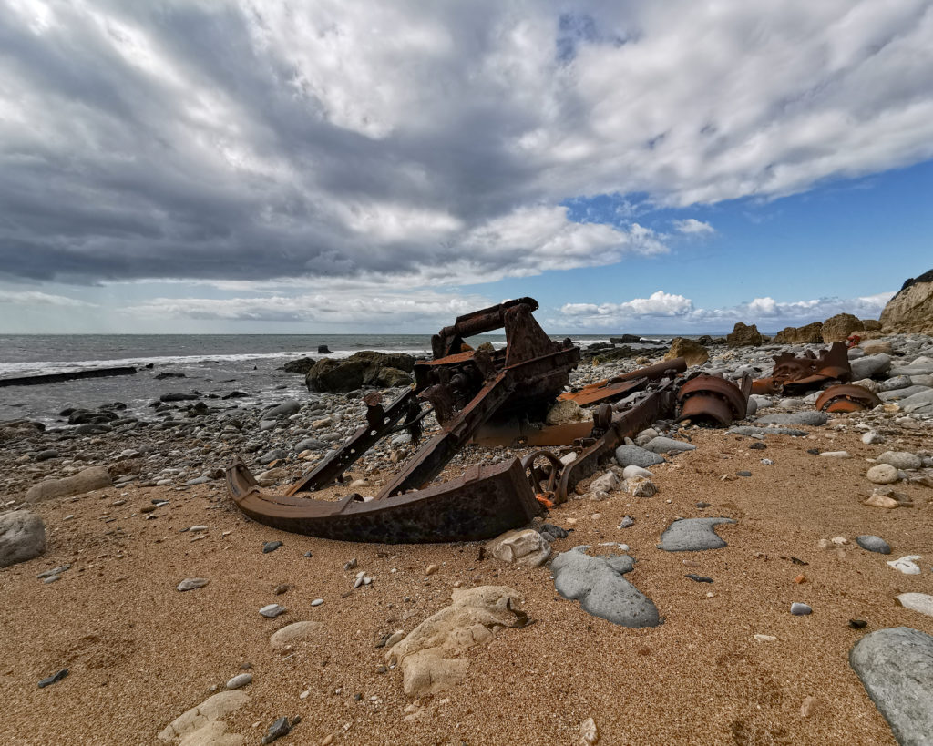
Beyond Corbin Rocks the geology around me shifts once more, the beach opens up and I stumble across the naked rusted bones of an old dredger wrecked on this isolated stretch of Devon shore. The bulk of the burnt orange metal carcass sits weathering on top of the pebbly sand, its bones picked clean by the sun, sea and waves; but there are other treasures to see, they’re just a little harder to discover and decipher.
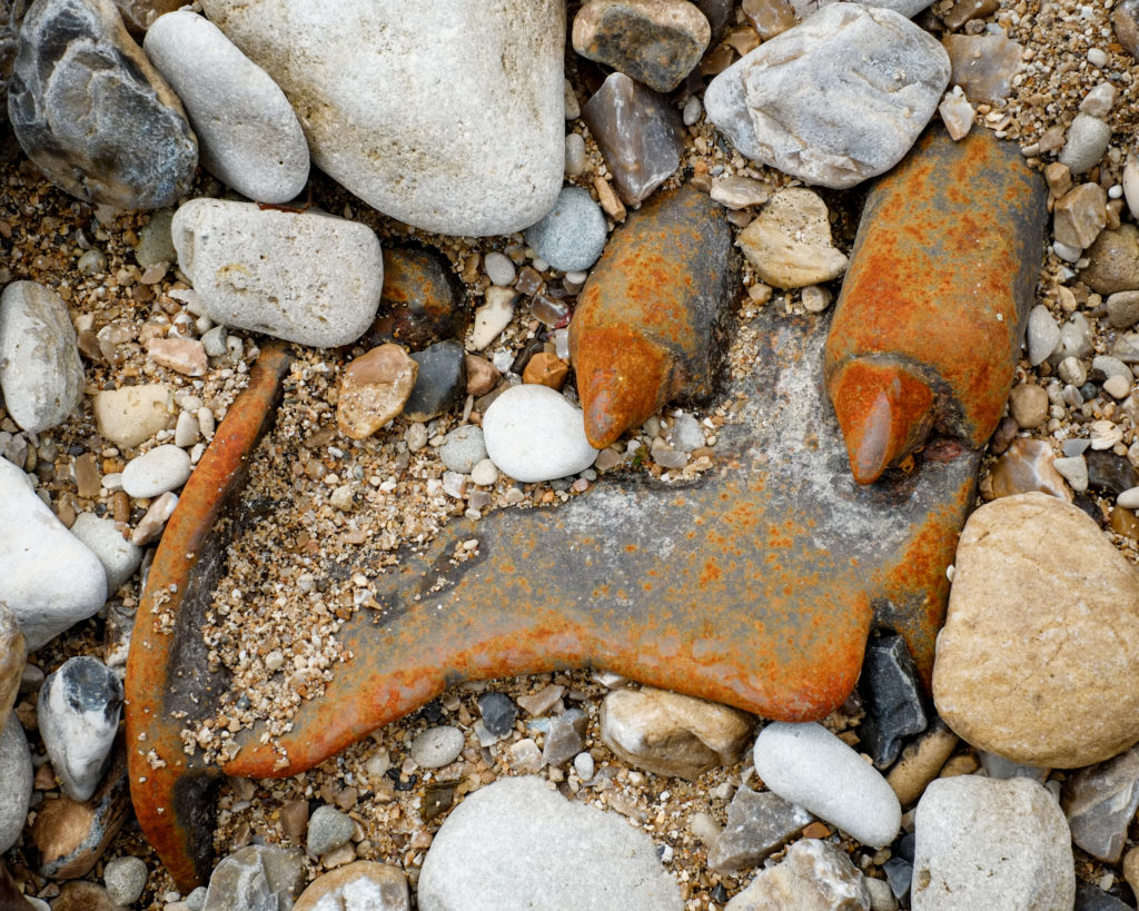
The claw of a buried digger bucket breaks through the sand for all the world like it’s trying to escape. Blood red teeth of an ancient gearbox are strewn amongst the pebbles. Old wheels, long removed from the short confining rails of the dredger deck, lie crumbling half buried – flakes of red brittle iron returning to the earth that gave them birth in the first place.
It seems fitting to me that here in the heartland of the Jurassic coast – the land of Mary Anning, famed for its fossils and geology – I’m looking at the rotting diesel powered bones of the Anthropocene.
To be continued…