Sands, sounds and bearings: Maps with no land
Maps are not ways of escaping. Things were always going to turn out like this.
By Jennifer Lucy Allan
From a pile of unorganised papers in a box I recently unearthed a map. A metre high, and over a metre across, it was printed in 1964 for the US Army. Across the middle, in a six inch high serif, is printed THE WORLD, but it is mostly blocked out blue sea, the only land the yellow tip of South Africa, a scraping of Antarctica, and small green pebbles of remote Atlantic islands. Evidently it is one sheet of a much bigger map of the world and all its parts, but out of context, pinned to my wall, it’s a case study in how we got here, and a reminder of how small we are. It throws me every time I look at it, the tiny islands tagged by European nations evidence of colonial history: an instant hit of perspective; a reminder of how much history stretches behind us.
Aside from the sharp point of the Cape of Good Hope, this map shows mostly water. As land dwellers we usually see the sea from the coast. They are where we are faced with the immediate and overwhelming presence of two massive geographical zones, not the realm of the human: air and sea. We think of the sea as something blank, inhospitable. We cannot live there, it will not support us. But the sea is not a blank space like my map shows.
Researcher and oral historian Erin Farley recently tweeted: “the sea is a place too and people do/did know its topography well. But at the same time, unknowable in its depths”. To see the sea’s topography, what’s under this blocked out blue, I turn to different maps: hydrographic maps, which invert the detail of my map, scattered with soundings, depths, buoys.
The National Library of Scotland has digitised all its historic hydrographic maps, an archive dump of watery topography. Aside from being incredibly beautiful, they also remind us of how changeable the sea is, how uncertain. Pencil marks show shifting sandbanks. These maps are for navigation, but these pencil marks remind me that the sea is more than just a stretch of water to be traversed.
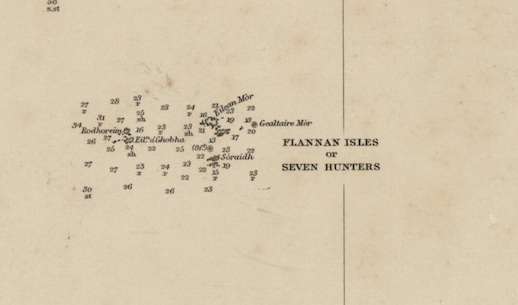
This one, of the north west coast of Lewis, also shows the Flannan Isles, where all three keepers disappeared without a trace in December 1900. When The Hesperus arrived for the relief, the lamps were trimmed and the washing up was done, but the clocks were stopped and there was no sign of any of the keepers. The story has been pored over by researchers, conspiracy theorists, and retold as a ghost story for a century, but what the original report from the scene speculated was that the men were carried away by freak waves. Other keepers have told stories of violent waves coming out of nowhere on isolated stations. The sea is more unpredictable than those of us that live inland assume.
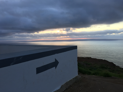
Back in February I stood on the western tip of Madeira, in front of Ponta Do Pargo lighthouse. Built in the 19th Century, it is one of the highest in the world, 290m above sea level on the top of a cliff that falls vertically into the vast expanse of the Atlantic below. There are no fences. I inched my way towards the edge, and perched on a dirt outcropping where the cliff juts into the sea, giving an uninterrupted 300 degree view of the ocean.
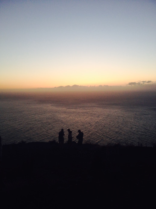
A rough calculation says that my horizon is roughly 23 miles away, although it looks like more. From this point, looking directly out to sea, there is no land until you hit the shores of North America. There is just salt water, save a few islets and small islands. On this tiny pinch of land I am almost nowhere, the edge of the edge of a small island.
I see no boats and no planes; no fish disturb the surface, just the tiny crests of ruffled waves. From up here how much and how far I can see is terrifying in its enormity. The calm, flat water, the absence of landmarks, or even any land, induces a kind of vertigo, prompted by the knowledge that there is nothing in front of me for thousands of miles.
Charles Olson, in Call Me Ishmael, writes: “Finding it vain to take in the sea’s vastness, man has taken to sounding it and weighing its density… It refuses to be studied or adequately comprehended. It still looms in my imagination, dim and indefinite.” From up here the ocean is a big flat blue blank like the map in my living room, but the hydrographic maps used by wreck divers around here is scattered with soundings, sunken ships, and the way Madeira slopes down into its tectonic plate far below sea level, the island just the tip of a massive ex-volcano.
There is a lot that is not dry land. Anthropologist Tim Ingold reminds us that the idea that humans make their way through a world which is full of solid objects “has its roots in a tendency, deeply sedimented in the canons of Western thought, to imagine that the world is presented to human life as a surface to be occupied”. Maps with no land flip that sentiment, remind us that most of the planet is watery, unoccuppied, inhospitable.
The sea was not mapped by Western powers until the 18th Century, in part by Francis Beaufort, who developed the poetic wind scale we still use in shipping forecasts today (‘force 12: sea completely white with driving spray’). Beaufort was an exceptional surveyor, so much so that his biographer Scott Huler manages to navigate using Beaufort’s original charts. Huler also writes about the context for Beaufort’s map making. Navigational charts were not standardised, so all maps were different. Many places were not mapped even if they had been ‘claimed’ by colonial forces, meaning that European land owners often ‘owned’ land that they couldn’t locate even if they wanted to.
The sea and Beaufort’s winds had a part to play in these colonial land grabs. The British, Dutch and Spanish getting out on ships ahead of other parts of Europe had at least something to do with geography: Britain’s position in the world is directly related to its surrounding seas. Access to the western Atlantic means a path straight down to the roaring forties, the strong westerly winds that carried sailing ships across the world, kicking off a historical trajectory that’s led us to where we are now.
If every man is an island, then every map is subjective, and these maps of the sea are showing me just one history. Maps with no land remind us of how much of the world resists human colonization – how much of the world can’t be lived on – but are also documents of colonialism and imperialism. They remind us that the way we think of our world, as solid ground, is just one way of thinking.
It’s a comfort and a terror to stare at these maps, to trace the movement of power across the world, to feel the weight of history and the passage of time, to claw back some perspective, and to see how much of the world is water, unconcerned with the infighting of the land dwellers.
Maps lend themselves to metaphors, and the sea is, as Olson put it, indefinite. On a good day the map in my living room reminds me that power has always been misused; that this is constant and global, and as a consequence, that the time we are now in is not the end, but is part of a continuum. In a platitude: life goes on. On a bad day, it becomes a metaphor for the unstable, inhospitable territory we find ourselves in. On both fronts, I am buoyed by a mantra my dad rolls out when me and my sisters lose our way in life: “You don’t need to have a plan,” he says, “but it helps to have a map”.