A series of posts following Tom Bolton – author of ‘London’s Lost Rivers’ and ‘London’s Lost Neighbourhoods’ – as he travels the coastline of the British Isles.
Words and images by Tom Bolton
We had spent the summer working our way along the Essex coast, mudflat by mudflat, but our visits had temporarily stalled as the autumn kicked in. No free weekends, too much to do away from the marshes. I did, however, have a visit planned back to South Warwickshire, where I had grown up and my parents still lived. There was always a walk involved.
My feelings about Essex, a landscape far from the Midlands in distance and form, were shaped by Warwickshire’s version of rural. At the edge of Essex there was no avoiding the sea, which encroached and subsided with the ebb and flow of each tide. To walk there was to be constantly reminded not only of visible surroundings – mud, river, sea, sky – but of places beyond, always just over the long, sharp horizon. On the coast, you had only to step in the water to embark on a voyage. Warwickshire, merging discreetly into its neighbouring counties, was a landscape of continuum. Lands across the seas seemed a lot further off than the 80 miles to the nearest tidal water. I wondered whether my few months of concentrated coast walking would have reshaped the gentle hills and arable valleys of the South Midlands.
We drove out in the late October sun to a place as remote as the M40 corridor has to offer, a tiny Buckinghamshire village called Wotton Underwood. The church was hosting a funeral, a procession of sombrely expensive cars crunching up a road that seemed more like a carriage drive. Wotton House, the former home of the Dukes of Buckingham and Chandos, had two pavilions which in themselves were large enough to have become private houses. The South Pavilion, we learned, had been the home of John Gielgud. Located discreetly off the beaten track but convenient for a quick run to the motorway, it now belonged to Tony and Cherie Blair.
Spread across the flat land north of Oxford were a series of strategic installations: Bicester Garrison, RAF Halton, RAF Brize Norton, the embarkation point for all troops leaving Britain and RAF Barford St. John, a link in the CIA’s global communications network. From the former US Air Force base at Fairford B52s had taken off for bombing runs over Iraq. Up on the Chiltern ridge, overlooking the valley below, was the Prime Minister’s official weekend home at Chequers. This was Patrick Keiller territory: the politics of land ownership, as explored in his film Robinson in Ruins, thinly disguised, pervading the valleys of the Thames and the Cherwell.
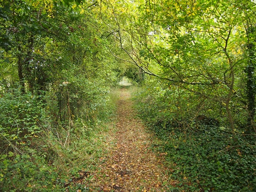
Our route had taken us along an abandoned private line called the Brill Tramway, which once connected Wotton House to the railway network, part of a failed venture to produce bricks on the estate. Remarkably, Wotton had also been part of the London Underground system. It lay at the far reaches of the Metropolitan Line, which had taken over the tram route in 1899. Until 1935 The Metropolitan Line trains ran a service from Aldgate, changing at Quainton Road junction. Trains passed through Wotton to terminate at the equally tiny village of Brill, carrying next to no passengers.
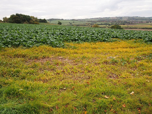
Our walk took us to Ashendon, a village on an isolated hill, which dominated the surrounding valleys. The view from the top showed us the Chilterns, filling the southern horizon. They formed part of the long chalk ridge which ran all the way to the Dorset coast, dividing England in two. On the other side lay London and the South East.
Back home in London, I visited a Paul Nash exhibition at the Tate which opened up the Midland landscape. Nash turned again and again to landscapes located in the fields and low, ancient hills of South Oxfordshire and Buckinghamshire. Concealed in full view from Ashendon Hill were Wittenham Clumps, the pair of sacred, wooded hills visible from Nash’s house at Boar’s Hill, west of Oxford. These Iron Age hill forts were strange totems, masquerading as ordinary scenery but existing in multiple, simultaneous flows of time.
Nash had also painted the Whiteleaf cross, a giant chalk hill marking hidden in the Chiltern folds by a mass of rusting beech hangers. It called north across the fields and over the county boundary towards the lost red horse of Edgehill, which had vanished among the encroaching trees in the early twentieth century. The Edgehill ridge stood over the Warwickshire valley in which I had grown up.
Nash’s last, visionary works drew intense energy from the layers of meaning encoded in the Oxfordshire landscape. His masterpiece, the airplane graveyard at Cowley Dump on the edge of Oxford, elevated tangled piles of metal into living forms, stirring in the moonlight. Under Edgehill, in the Vale of the Red Horse, the Ministry of Defence base at Kineton covered the countryside with bunkers, topped by mysterious, pyramid forms. The base was off-limits, home to an ammunition dump that had once housed Britain’s nuclear deterrent. From the mid-1950s, V-bombers had begun arriving at the nearby Gaydon Airfield to carry new American Skybolt nuclear missiles, armed with Yellow Sun warheads.
I grew up a couple of miles down the road, in the village of Wellesbourne. My primary school, built in the late 1950s, sat in at the centre of a loop road lined with detached and semi-detached brick houses and bungalows. They had wide lawns, thick, trimmed hedges and dahlias. It was only during my October visit, many years after the fact, that I realised: the houses had been built for the RAF officers newly arrived at Gaydon to fly the nuclear deterrent. The rank and file were housed in an estate on the other side of Wellesbourne. The village school was too small for the influx, and a brand new primary had been built for the RAF families.
In 1962 President Kennedy cancelled Skybolt, and Britain’s nuclear arsenal switched to the Polaris submarines. All the RAF arrivals had moved out again, but MoD Kineton had continued to store nuclear warheads. It was now reported to be the largest ammunition dump in Western Europe. The pyramids were believed to be designed to deflect a nuclear blast.
A collage piece by Paul Nash called In the Marshes had caught my attention at the Tate. It was composed from bark and plant stems, three of which were laid open to expose their yellowed, spongy cores. The marsh had surrendered them in 1938. Nash believed that landscapes held meanings which, rather than being hidden, were simply not perceived. ‘Unseen’ places and the objects they contained – tree trunks, shells, stones, pieces of wood – seemed to come alive the more he observed them, as though he was reawakening dormant spirits. He described how “There are places, just as there are people and objects and works of arts, whose relationships of parts creates a mystery, an enchantment, which cannot be analysed.”
This intuition seemed an important lesson for the Essex coast. Looking and looking again, particularly at places that seemed most familiar, could draw out their secrets. The most comfortable street from my childhood, which I walked along to school every day, had become something entirely different. Rather than the domestic setting I had always taken it for, it was revealed as a link in a global defence system, a Cold War installation. Now the Warwickshire edges seemed suddenly obvious, Edgehill hiding in plain sight. When our Essex project resumed, we would be delving even deeper beneath the mud, looking for lost gods and concealed bunkers.
*
See previous Edge Walking posts here.
Tom Bolton on Caught by the River/on Twitter