A series of posts following Tom Bolton – author of London’s Lost Rivers and London’s Lost Neighbourhoods – as he travels the coastline of the British Isles.
We returned to Essex the day Article 50 was triggered. Brexit had a created new language, enormous implications packed into a portmanteau phrase, or hidden behind a paragraph number. Since our walk began in the Spring of 2016, a political storm had been unleashed, gathering on the eastern fringes of Britain, and lashing the country. We had been in the right place to observe, but we were still unsure what we had really seen.
The Friday night train from Liverpool Street had shed all its other passengers by the time it reached Walton-on-the-Naze, the end of the line. Walton, still out of season, was equally deserted too. The car showroom lighting the seafront turned out, on closer inspection, to be a large mobility scooter dealership. In the uncurtained bay window of a seaside block, a woman stood motionless, back turned, in an old-fashioned hat and coat, as though she had been been ready and waiting for thirty years. The pub where we had booked a room contained only a barman, whose greeting ‘Good Sir’, turning his jollity level to maximum to fill the empty saloon. From the beer garden we saw two lights far out in the blackness, beyond the pier, flashing in sequence with each other. Their message was undecipherable, but next morning we calculated that they belonged to the Sunk Light Vessel, and to the independent territory of Sealand.
A deserted Second World War anti-aircraft platform called Roughs Tower had become famous as after declaring independence in 1967. The fort, eight miles off the Essex coast, had proclaimed itself a sovereign territory with the uninspired name of Sealand, following a strange series of violent confrontations at the height of the pirate radio boom. It was one of four Maunsell Forts built to defend the Thames Estuary from Nazi attack. Roughs Tower, just outside UK territorial waters, later proved irresistible to pirate operators. When ex-army major Roy Bates took control of the platform from ‘pirates’ already in residence, he planned to install his Radio Essex station, which had previously broadcast from Knock John Tower, just inside British territory.
Ex-army types and pirate radio proved a volatile combination. Apparently men from Radio Caroline tried to take over Fort Roughs, but were held off by Bates, armed with petrol bombs. There was a trial in which Major Oliver Smedley of Radio Caroline was acquitted of killing Radio City’s Reginald Calvert, shot in a dispute over another fort off the Kent coast. The government decided pirate radio had gone too far, and sent the Royal Navy to demolish the forts outside British jurisdiction. They blew up Sunk Head Fort, but when they approached Roughs Tower Bates and his son fired warning shots. Bates then declared independence from Britain, and a court subsequently found that, as the confrontation took place outside the UK, there was no case to answer.
Bates, took to his tiny country with enthusiasm, inventing a flag, passport and currency and declaring himself to be Prince Roy and his wife Princess Joan. IN another outbreak of armed violence, a sub-Bond style raid by a group of Dutch and German chancers led to the German government having to formally negotiate the release of one of their nationals, held for ‘treason’ by Bates because he possessed a Sealand passport. Since then, governments had sensibly ignored the platform, while Roy’s son Michael inherited the title of Prince and devoted himself to flogging titles and an impressive range of tourist bric-a-bric from the Sealand website. The story was plucky, murky and tacky in equal measures.
By morning, Walton had woken from its deep slumber. Our pub revealed itself as a Georgian hotel, its first floor occupied by a ballroom of remarkably size and elegance. The population of Walton included not only a retired contingent, but also an alternative one, with a higher proportion of dyed blue beards that any other part of the Essex coast. The coast path led through a village of beach huts inhabited by friendly pensioners and out on to the Naze, home to the curious, octagonal Naze Tower.
The Naze was a ness, a headland protruding into the North Sea in the general direction of the Hook of Holland, and the easternmost point in Essex. New paths had been recently cut through the low gorse and the low trees, away from the collapsing cliff edge. Its tower was built in 1720 as a warning beacon for shipping, and was remarkably tall for its time. It looked like the remains of a vast, outlandish Tudor palace. From the top, up many spiral stairs, Suffolk was visible. Orford Ness lay flat on the horizon. The rate of erosion beyond Orford, which had famously drowned the town of Dunwich, was only matched by the retreating cliffs on the Naze. The Naze had once extended more than four miles further out, but the original town of Walton was also under the sea. In 1789, as the French Revolution across the water shook the Continent, All Saints church had toppled off the cliff.
The Naze was still losing two metres every year, and a new stretch of coastal protection had just been completed, designed to keep the Tower safe for another hundred years. In the Tower shop we heard that the locals had built their own defences on the Naze the previous summer, filling wire gabions with stones to protect the town sewage works. We were offered us shark’s teeth, smooth and dark like flint, sold in small plastic bags. They were 20 million years old, jars full collected from the beach. The erosion was releasing more of the past every day, and the local museum was full of auroch bones and mammoth teeth disgorged from the pre-Ice Age tundra.
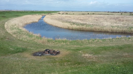
The gantry cranes at the Port of Felixstowe, the largest in Britain, were visible through haze on the far side of the Stour estuary. We turned the headland on fresh paths through the scrub, cut to replace last summer’s tracks which had fallen into the sea. The Naze sheltered a maze of small tidal islands, known locally as the Backwaters and officially as Hamford Water. This was the setting for Arthur Ransome’s 1939 book Secret Water, the eighth in the Swallows and Amazons series. En route to their Essex holiday, the Swallows’ father is called back to his job with the Navy in London, so the children explore Hamford Water on their own. They pitch camp above the mud line, and sail the channels with their Amazon friends and locals, the Eels, mapping Hamford Water. I knew this landscape in great detail, having pored over the children’s maps when I was young. However, unlike the Lake District settings of earlier books, which I had visited, I had no sense of this being a real place. As the islands of Hamford Water appeared in front of us, I experienced an unusual sense of a book coming to life, gently unfurling with the tidal wash.
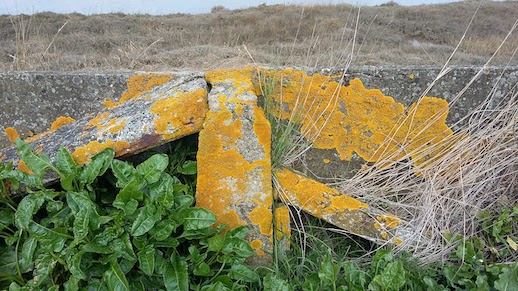
The coast path was thick with lush green sea beet, and the rail cement seawall was splashed in bright yellow lichen. There was feathery sea fennel and hawthorn banks in full white bloom. We walked the same route from Walton the Swallows had taken in Secret Water which, as they discovered, is further than it looks. Skipper’s Island is only accessible on the Wade, a causeway covered at high tide. The Swallows had stopped for a nap, reaching the Wade late, and were stranded halfway across, leading to a last minute rescue. When we reached the Wade, it was entirely submerged. In real life Skipper’s Island is off-limits, a nature reserve where the pretty brown Fisher’s estuarine moth can dine on sea hog fennel, lacking elsewhere. Visitors are kept away by a warden and the sea by walls built, according to him, by prisoners during the Napoleonic Wars.
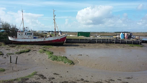
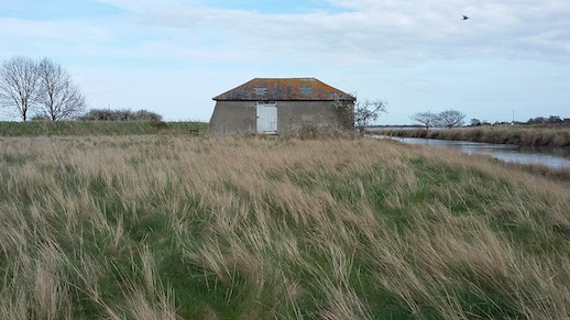
The Backwaters were deserted. At Kirby a miniature quay was overlooked by an ancient black, weatherboarded house, the Witch’s Quay in Secret Water. A kestrel floated in our eyeline over the path, always keeping a hundred yards ahead of us. An egret swooped over the channel, and we could hear skylarks somewhere up in the banking grey cloud. The top of a red sail sliding silently along the creek above the seawall. To the left, away over ploughed fields, lay Landermere Hall and on the estuary, another secret quay, Landermere Wharf, where corn, coal and wood from Scandinavia where once landed.
Eduardo Paolozzi, Nigel Henderson and their respective families moved into adjacent cottages at Landermere Wharf in 1954. Paolozzi was a sculptor from Leith, who had established himself in the avant garde bastions of Paris and Chelsea. Henderson was best known for his photographs of the East End, including Grove Road in Bethnal Green where, forty years later, Rachel Whiteread would cast the ghost interior of the demolished House. Together, in deliberate exile from London, they set up Hammer Prints Ltd, a homemade design operation, based at from Landermere Wharf. Their designs combined the beginnings of pop art with what became known as ‘brutalism’, creating textiles and wallpaper design that came from the materials surrounding their Essex retreat, which defining the graphic style of the time.
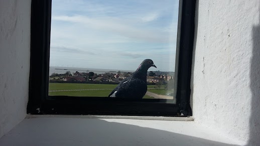
Reaching the end of the channel, we reluctantly left the parallel world of Hamford Water and headed inland to the station at Thorpe-le-Soken. Outside the Thorpe Social Club a group of men waited on the pavement with a stack of crates containing live pigeons. A silver car hooted us as we walked along the pavement leading to the station. The station was dominated by a vast building, the former Thorpe Maltings. Along with the station hotel it had been fenced off and left to collapse, which it was doing in a spectacular and comprehensive fashion. Such ostentatious neglect seemed menacing. We were unsure what to make of Thorpe, but booked a date to return and walk north to Harwich. We were reaching the final stages of our Essex expedition.
*
See previous Edge Walking posts here.
Tom Bolton on Caught by the River/on Twitter